- Home
- Satellites
- WorldView-2 (0.46m)
WorldView-2 Satellite Sensor (0.46m)
DigitalGlobe's WorldView-2 satellite sensor, launched October 8, 2009, provides 0.46m panchromatic (B&W) mono and stereo satellite image data. Watch video of WorldView-2 satellite launch.
WorldView-2 Satellite Sensor (0.46m)

(Image Copyright © DigitalGlobe)
The WorldView-2 sensor provides a high resolution panchromatic band and eight (8) multispectral bands; four (4) standard colors (red, green, blue, and near-infrared 1) and four (4) new bands (coastal, yellow, red edge, and near-infrared 2), full-color images for enhanced spectral analysis, mapping and monitoring applications, land-use planning, disaster relief, exploration, defense and intelligence, and visualization and simulation environments.
With its improved agility, WorldView-2 is able to act like a paintbrush, sweeping back and forth to collect very large areas of multispectral imagery in a single pass. WorldView-2 alone is able to collect nearly 1 million km2 every day, doubling the collection capacity of our constellation to nearly 2 million km2 per day. The combination of WorldView-2’s increased agility and high altitude enables it to typically revisit any place on earth in 1.1 days, revisit time drops below one day and never exceeds two days, providing the most same-day passes of any commercial high resolution satellite.
The WorldView-2 imaging payload is the second such system engineered and manufactured by ITT Space Systems Division for DigitalGlobe. WorldView-2 operates at an altitude of 770 kilometers, and the advanced on-board imaging system can capture pan-sharpened, multispectral images (with better than 0.46-meter resolution) from almost 500 miles above the earth. These images supply unprecedented detail and geospatial accuracy, further expanding the applications for satellite imagery in both commercial and government markets. Added spectral diversity provides the ability to perform precise change detection and mapping.
In addition to numerous other technical improvements, WorldView-2 also has the ability to accommodate direct tasking, which will allow select customers around the world to load imaging profiles directly up to the spacecraft and execute delivery of the data directly down to their own ground stations.
Sample Images
Atmospheric Compensation - DigitalGlobe AComp Pre-Processing
WorldView-2 Satellite Image Gallery
WorldView-2 Satellite Sensor Specifications

Click on image to view in full resolution
Burma, Ragoon, Myanmar Shwedagon Pagodas |
Bin Kaneh, Iran Destroyed Missile Facility |
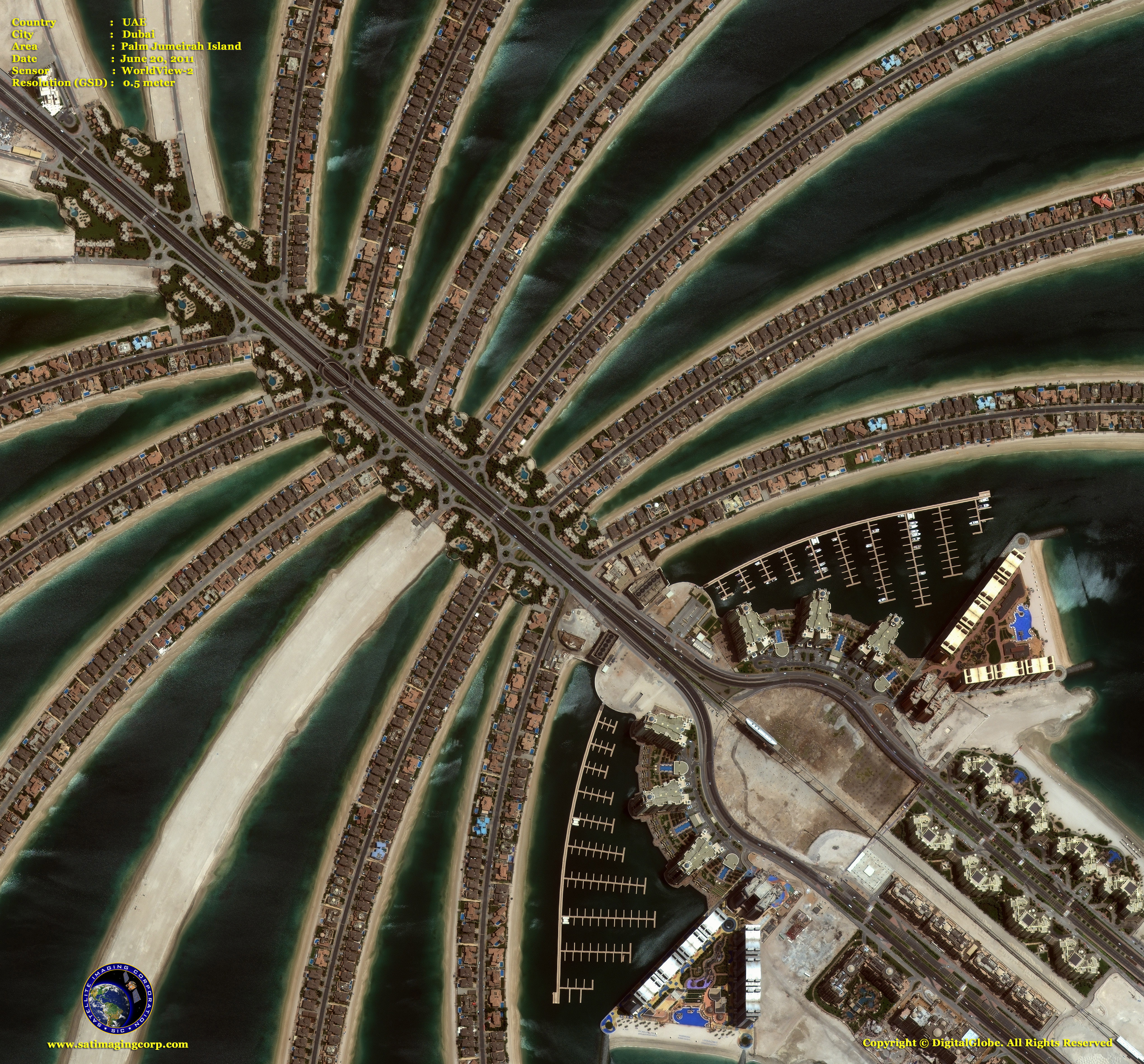
Dubai, UAE Palm Jumeirah Island |
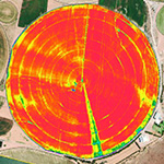
NDVI Ag Pivot South Africa |


|
WorldView-2 Specifications - PDF Download
Satellites Currently Operated by DigitalGlobe
WorldView-4 Satellite Sensor (0.31m)
WorldView-3 Satellite Sensor (0.31m)
WorldView-1 Satellite Sensor (0.46m)

Technical documents are available for this sensor. Choose one to download it.
- WorldView-4 (0.31m)
- WorldView-3 (0.31m)
- WorldView-2 (0.46m)
- WorldView-1 (0.46m)
- GeoEye-1 (0.46m)
- Pleiades-1A (0.5m)
- Pleiades-1B (0.5m)
- SuperView-1 (0.5m)
- KOMPSAT-3A (0.55m)
- KOMPSAT-3 (0.7m)
- QuickBird (0.65m)
- Gaofen-2 (0.8m)
- TripleSat (0.8m)
- IKONOS (0.82m)
- SkySat-1 (0.8m)
- SkySat-2 (0.8m)
- Jilin-1 (1m)
- TerraSAR-X
- SPOT-6 (1.5m)
- SPOT-7 (1.5m)
- Other Satellites (2m-20m)


