Recent Imagery
How Landsat Helps
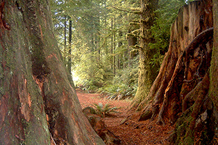
ecosystems and biodiversity
The Landsat Program
This joint NASA/USGS program provides the longest continuous space-based record of Earth’s land in existence. Every day, Landsat satellites provide essential information to help land managers and policy makers make wise decisions about our resources and our environment. + Landsat Case Studies ebook
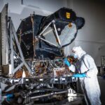
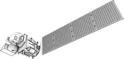
Landsat 9 Instrument Ready for Spacecraft Assembly
OLI-2 is now built, tested, and in place to be assembled onto the spacecraft.
+ details
New Landsat Infrared Instrument Ships from NASA
This month, TIRS-2 successfully passed the stringent 12-week testing process at NASA’s Goddard Space Flight Center and was shipped to Northrop [
…]
More than Naught: The “Z” of Where Land Meets Sea
Harnessing 30 years of Landsat data, a team of researchers from Australia has created the first 3D model of Australia’s entire coastline.[
…]
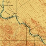
Geographia
Journey with us into the cartographic past. Latest look: Creating an Oasis in the Desert: Lake Havasu City, Arizona, 1911 [
…]
“Because of Landsat’s global purview and long history, it has become a reference point for all Earth observation work and is considered the gold standard of natural resource satellite imagery.”
“The Landsat collection 1 datasets represent a milestone in remote sensing science, with comparatively stable radiometric calibration and atmospheric correction.”
“We are now beginning to see that the combination of high performance computing, data storage facilities, data preparation techniques, and advanced systems can materially accelerate the value of Landsat data.”
“One of the things we like about the [Landsat] satellite is that as it orbits the Earth it is calibrated consistently so we have a globally constant picture that we can make comparisons—apples to apples—of what’s happening. We can drill down to countries, even parks, and say this is what is happening at a local scale. That is another really powerful part of this big data story.”
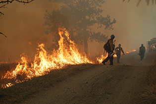
“Fire perimeters collected using Landsat imagery are accurate, timely and cost-effective.”
“Landsat provides a very good coverage of Amazonia both spatially and temporally. We have known for some time already that the Landsat images can be used to identify ecologically relevant environmental and biotic variation in Amazonian rainforests, but this is the first time we use satellite images to actually predict species distributions.”
“Having Landsat 9 in progress, and a long-term commitment to sustainable land imaging, is great for natural resource science and for data-driven industries such as precision agriculture and insurance.”
“Landsat offers a globally consistent data set with a short enough revisit time to allow us to consider the percent of time that surface water is present on an annual and seasonal basis, while its 30 meter resolution also enables detection of smaller ponds and rivers, providing greater connectivity.”
“From now on, we’re going to be able to track all of the different types of changes in glaciers – there’s so much science to extract from the data.”
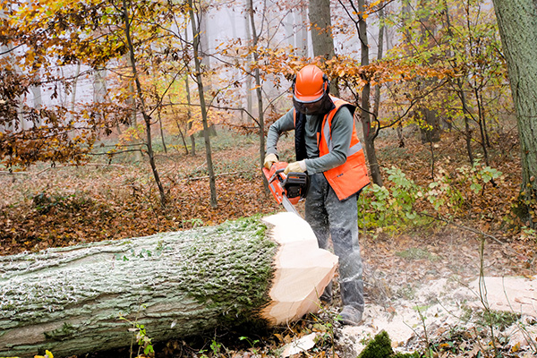
“We recognize the essential role forests play in the long-term health of our planet, in contributing to sustainable development, and in meeting our shared goal of avoiding dangerous climate change. More than a billion people depend directly on forests for their livelihoods, and the remaining six billion of us depend on forests for a variety of economic, social, and environmental benefits such as the rainfall, biodiversity, pollinators, carbon storage, and …
— Leaders of Australia, Brazil, Canada, Colombia, Democratic Republic of Congo, Ethiopia, France, Gabon, Germany, Indonesia, Japan, Liberia, Mexico, Norway, Peru, United Kingdom, and the United States , Dec 1, 2015
“The long, consistent view of Earth from space provided by Landsat sparks advances in science, enables more efficient natural resources management, and promotes profitable applications of the data in commerce and industry. In step with the National Research Council and other objective reviews, the non-federal Landsat Advisory Group has found that the broad benefits of Landsat far outweigh the cost.”
“Landsat is the longest civil satellite data collection we have. The USGS opening the archive has created opportunities for instructors like us to integrate students.”